IREA chooses ONDA for large scale InSAR data processing
IREA, the Institute for Electromagnetic Sensing of the Environment of the National Research Council (CNR) of Italy, has selected ONDA, through a public invitation to tender open to the DIAS platforms, to provide cloud resources for processing Sentinel-1 data.
IREA has already been using the ONDA platform as an early adopter for the development of surface deformation products implementing interferometric SAR (InSAR) techniques.
“We are very pleased to continue our collaboration with ONDA,” said Riccardo Lanari, the IREA director. “We believe that the flexibility and reliability of the ONDA platform will be a benefit for us, especially as regards our developments on large scale InSAR data processing.
Indeed, these characteristics can be particularly relevant for our activities, carried out to support the Civil Protection Department of Italy and the Satellite Data Thematic Core Service of the European Plate Observing System (EPOS), which is the European Research Infrastructure Consortium (ERIC) focused on Solid Earth.”
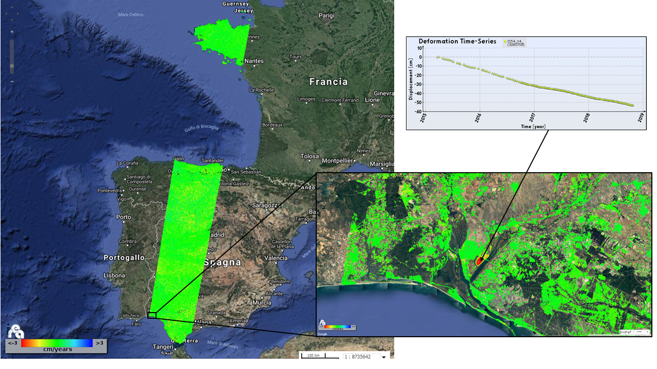
The figure above is an example of the products processed by IREA through the ONDA cloud resources, and shows the results related to the generated mean deformation velocity maps and the corresponding time series of 7 slices of the descending Sentinel-1 track no. 154.
Note that a large area of Spain is mapped through the first 6 slices, while the 7th one covers Normandy. To give an idea of the information content of the generated products, a zoom of a selected area (showing a localized deformation pattern) is also presented, as well as the retrieved deformation time series of one pixel.
The overall mapped area extends for almost 150000 km2 and for each slice a number of Sentinel-1 images ranging from 142 to 160 was processed.
Learn more:
- IREA Earth surface deformation project on ONDA Marketplace
- IREA (Institute for Electromagnetic Sensing of the Environment)
- CNR (National Research Council)
- Civil Protection Department (Italy)
- European Plate Observing System (EPOS)
- European Research Infrastructure Consortium (ERIC)